

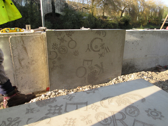
I have undertaken a broad range of projects, from small-scale
community-led initiatives, through major public art installations
and temporary interventions, to city-wide master-planning schemes.
I have successfully collaborated with a variety of organisations
and fellow professionals (artists, architects, design consultants,
arts officers, community groups and local authority planners) and
have experience of working at all phases of a project, from
initial concept development through to installation, tailoring
designs and preparing artwork for a range of materials (including
concrete, wood, metal, vinyl, and glass) all with full
consideration to maintenance and sustainability issues.
Notable commissions include: balance/flow, (with Rob
Colbourne) a sculptural boundary feature for Birmingham Coach
Station (commissioned by National Express, 2010); Tamed,
(with Rob Colbourne) graphic concrete treatment and landscaping
for a flood defence scheme in Witton, Birmingham (Environment
Agency, 2016); Double Thread, (with Rob Colbourne)
site-specific works for a residential development near
Wolverhampton (David Wilson Homes, 2014); various interventions
for the Seahouses Development Trust, Northumberland (2011); and Hidden
Histories, printed map and workshops for Munslow Parish
Council, Shropshire (2006).
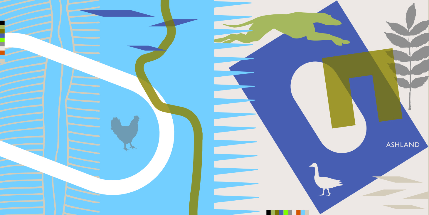 Ashland
Flag, design (for publication, tea towel, flag) developed
from research at the site of a new residential development in Milton
Keynes (2011).
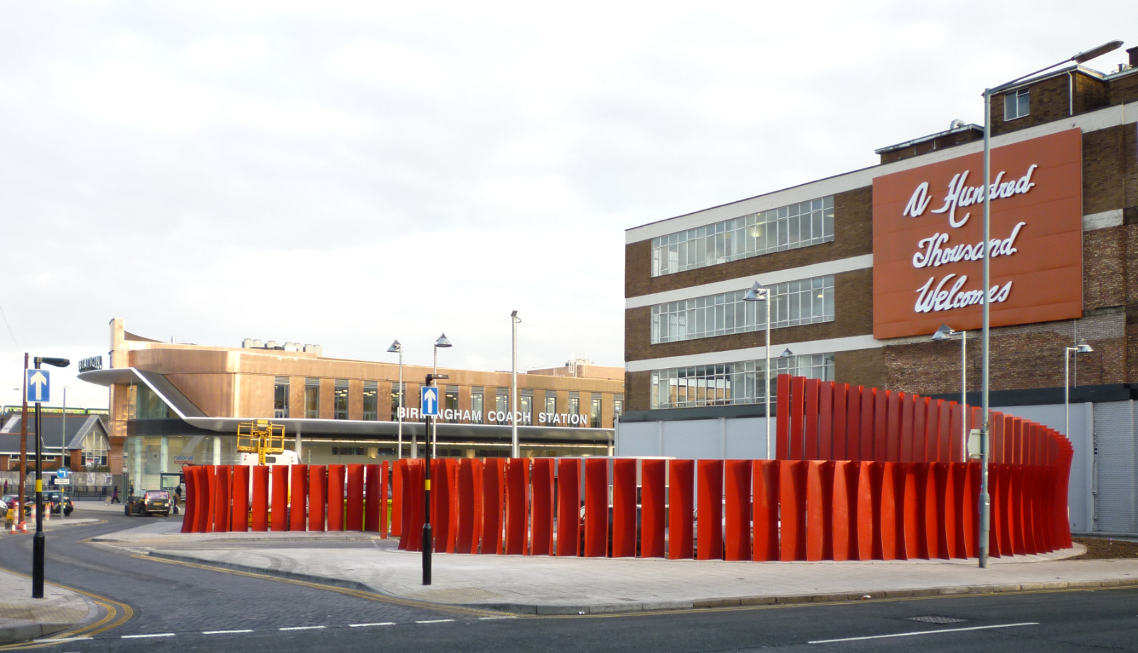 balance/flow,
boundary feature for National Express Birmingham Coach Station
(2009).
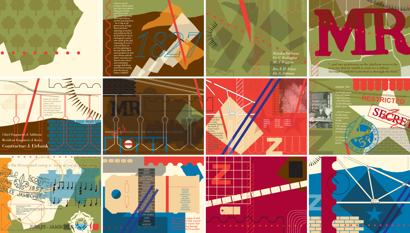 Birmingham
Z, postcard designs developed from research into the site of
a residential development in Sutton Coldfield (2011).
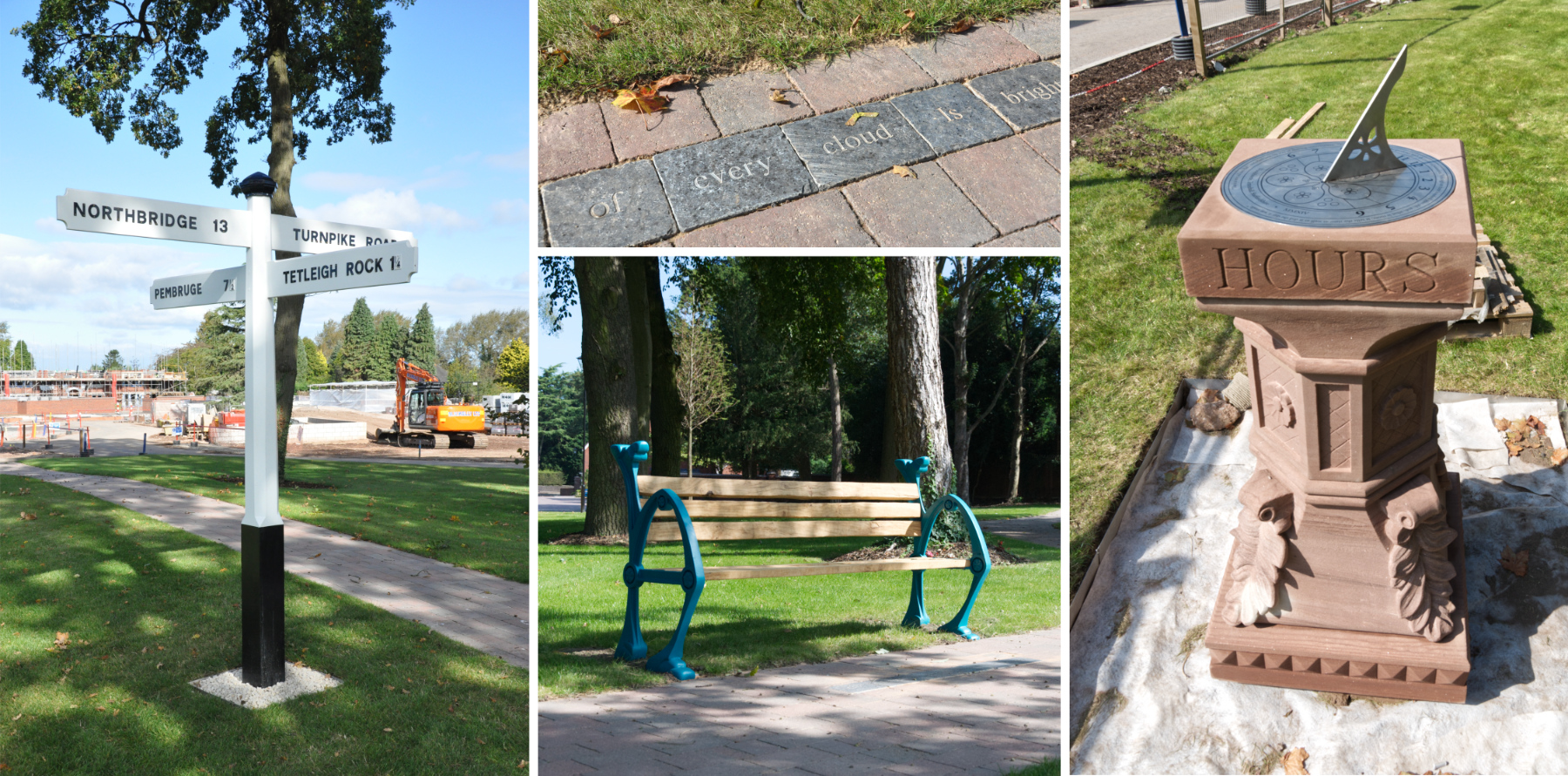 Double
Thread, various works for a residential development near
Wolverhampton (2014).
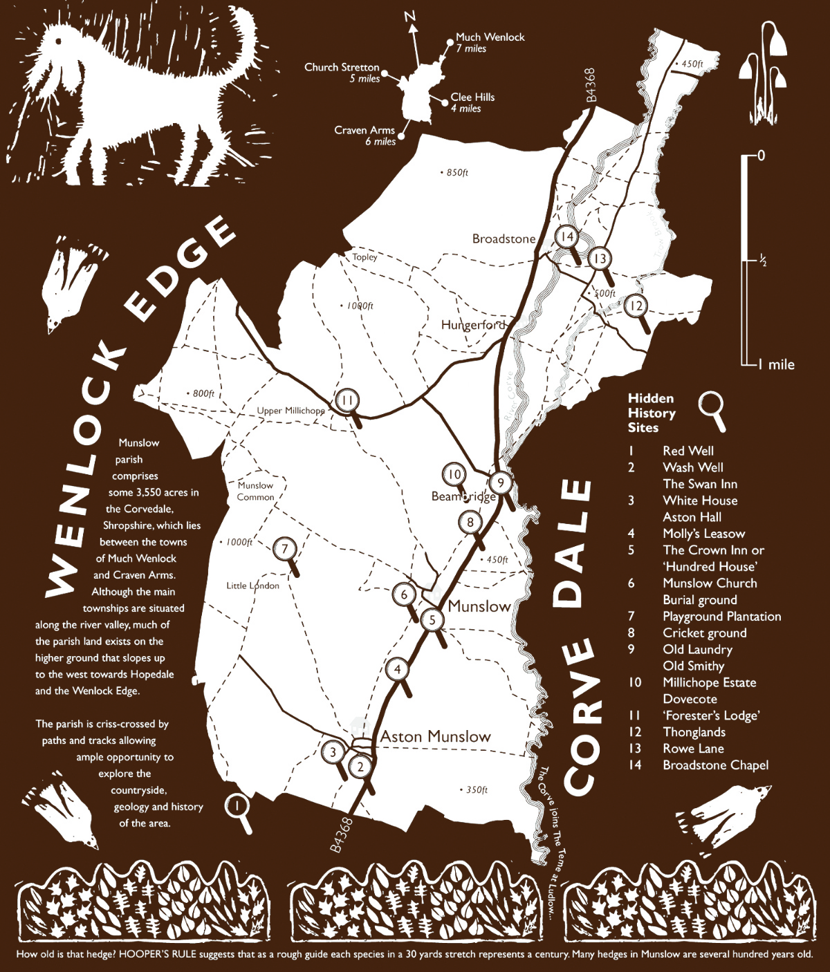 Hidden
Histories, map developed for Munslow Parish Council using
content gathered during group walks and created in art workshops
(2006).